Coastal resilience assessment areas where conservation projects would best protect human communities and improve habitat for wildlife
The National Fish and Wildlife Foundation (NFWF) has announced the release of the Regional Coastal Resilience Assessment and the creation of a new analytical tool that can identify specific coastal areas with the greatest potential to boost community resilience while also improving habitats for fish and wildlife.
For nearly four years, NFWF has partnered with UNC Asheville’s National Environmental Modeling and Analysis Center (NEMAC), as well as NOAA, in conducting the Regional Assessment and creating the new Coastal Resilience Evaluation and Siting Tool (CREST). The U.S. Army Corps of Engineers provided review and comment.
“Protecting communities while benefiting wildlife is a huge win-win for coastal regions of the United States,” said Jeff Trandahl, executive director and CEO of NFWF. “The assessment and this new tool will help conservation nonprofits, government agencies and local communities identify areas where they can maximize return on investment and achieve multiple community resilience and conservation outcomes.”
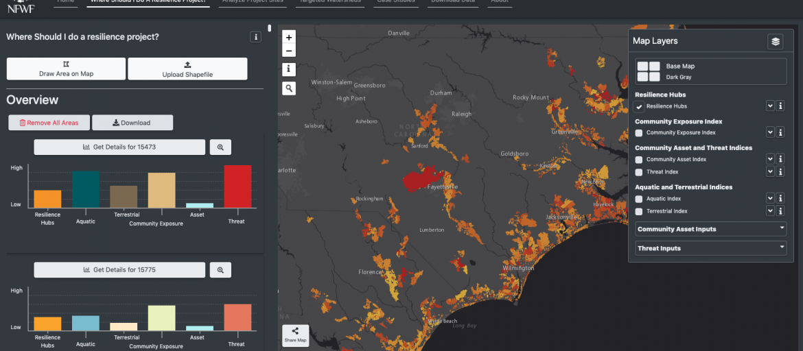
The Regional Assessment and CREST use nationwide, standardized datasets to analyze potential project sites throughout the U.S. Atlantic, Gulf of Mexico, and Pacific coastlines. The tool identifies “Resilience Hubs,” areas of open space surrounding the densest population centers and immediate community infrastructure, where valuable natural resources and habitats can provide protection to human populations and critical infrastructure that face the greatest risk of flooding from coastal storms and changing sea levels.
CREST is not intended to supplant but may serve as a useful complement to ongoing or completed state and community level coastal restoration and protection plans.
Access to CREST, available online at ResilientCoasts.org, allows users to explore the assessments, underlying data, and to find potential restoration opportunities. In addition, users can analyze specific project sites for their benefits to fish and wildlife habitat and to community resilience. Complete data, including input datasets, are also available for download.
All assessments are available through NFWF’s website here, along with final reports, maps and detailed methodology.
Share
Permalink: